Shipping Estimate
USA
- USA
- CAN
- USA
- CAN
Ships within 48 hours · Estimated delivery Jul 7 - Jul 12
For Your Every Summer RSVP, with Code: SUMMER15
Description
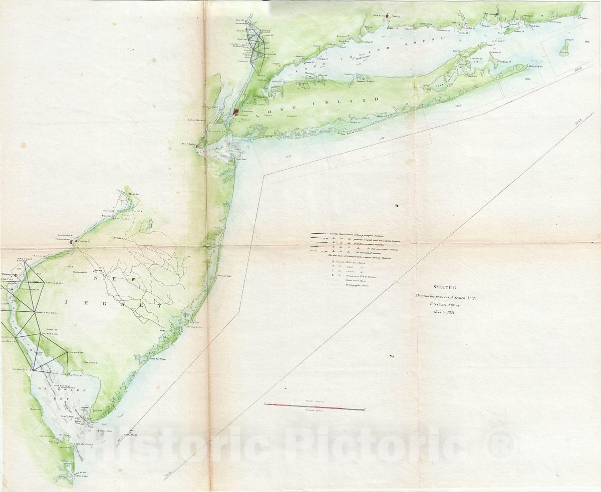
Historic Map : U.S. Coast Survey Map of New Jersey, Long Island and New York, 1851, Vintage Wall ArtThis is an unusual triangulation chart of the New York and New Jersey coast line from the scarce 1851 edition of the Superintendent's Report. It covers from the Delaware Bay north to New York City then east along Long Island as far as Block Island. Shows various triangulation points and some of the attached river systems. New York City, Philadelphia, Wilmington, Trenton, Newark, Elizabethtown, and New Haven are noted. The 1851 edition of the
This is an unusual triangulation chart of the New York and New Jersey coast line from the scarce 1851 edition of the Superintendent's Report. It covers from the Delaware Bay north to New York City then east along Long Island as far as Block Island. Shows various triangulation points and some of the attached river systems. New York City, Philadelphia, Wilmington, Trenton, Newark, Elizabethtown, and New Haven are noted. The 1851 edition of the Superintendent's Report is highly unusual in that its maps do not have borders, common to all subsequent editions.
Shipping Notes
- Free Standard Shipping on $100+ Orders to the USA.
- Except Preorder products are shipped in 48 hours.
- Delivery to the USA:
- Standard Shipping : 3-10 business days
- If time is of the essence, please consider selecting expedited delivery for faster service.
Exchange/Return Notes
- We offer a 30-day return/exchange service after receiving.
- Final sale items are not eligible for returns or exchanges.
- To process your return/exchange, please contact us at [email protected]
- Please click here for more details>>> Return & Exchange Policy